Collective Outing No. 03 · Valley Green brunch + the red covered bridge · Sun Nov 8
Collective Outing No. 03 · Sun Nov 8 · meet 11:15 at Valley Green Inn · brunch 11:30, walk at 1 · about 3 mi of flat gravel. 1 Park · 2 Valley Green Inn · 3 Rex Avenue Bridge · 4 the red covered bridge. Map + calendar in the page.
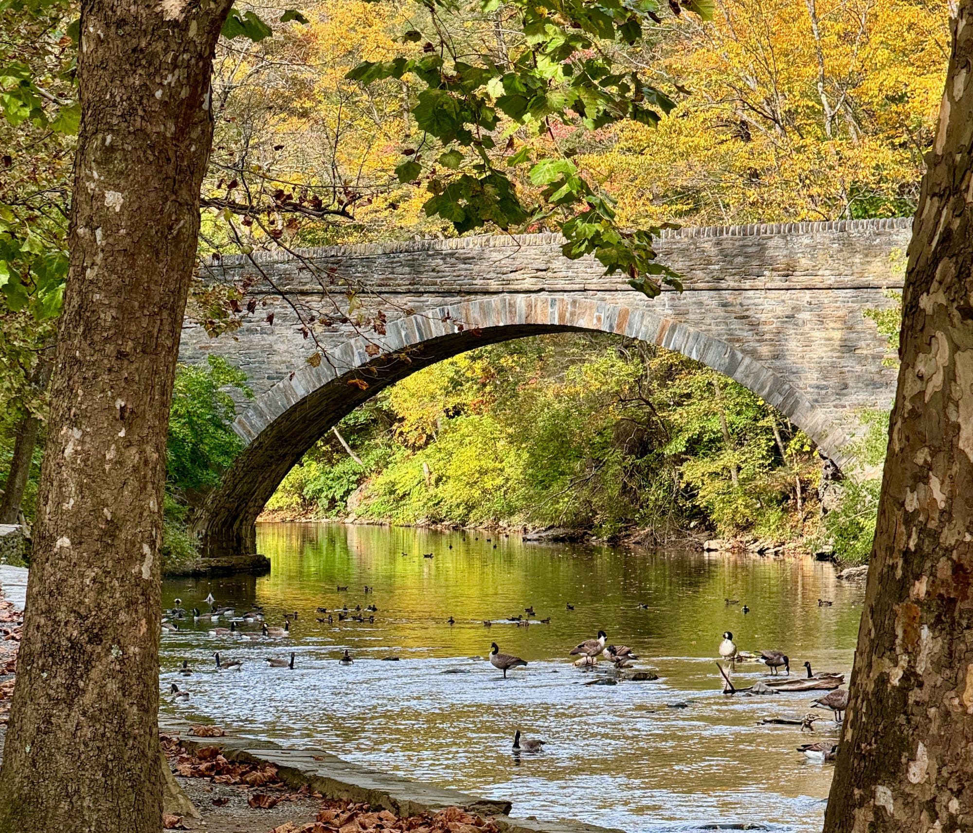

Sun Nov 8 · 11:15 · Valley Green brunch + the red covered bridge · come walk it
1 Park: Valley Green Lower Lot South, beside the Inn · backup Lower Lot North (Wises Mill Rd)
2 Meet + brunch: Valley Green Inn · 11:15 · brunch 11:30 · book a table
3 Walk at 1: Forbidden Drive north, past the Rex Avenue Bridge
4 Turn back: Thomas Mill Red Covered Bridge · about 3 mi round trip, flat gravel
Back at the cars about 2:30. Sunset 4:51.
Calendar: outdoor.unitedinnature.com/plan-it-valley-green/ · Walked it? Tag us or reply with a photo.
Collective Outing No. 03. Long-press the card above and send it to the group chat.
Follow along on Instagram and X for the next outing.
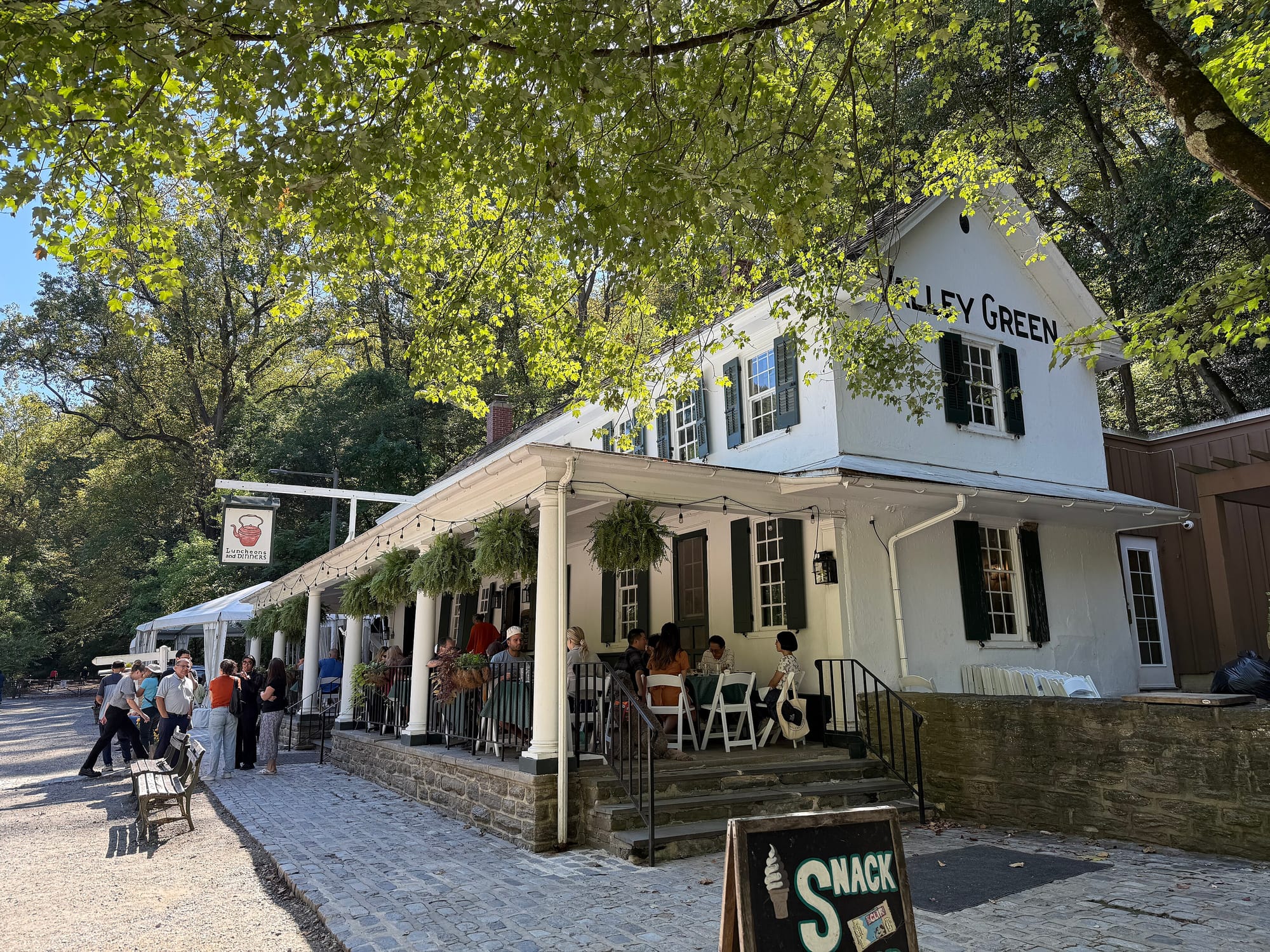
The Wissahickon used to be lined with roadhouses. Visitors came up the creek road by carriage and on horseback, ate catfish and waffles, and in winter they skated on the water. One of those places is still open. Valley Green Inn went up in 1850 and 1851, nearly came down in 1899, and was saved by a local committee that raised $1,228 to fix it. The Friends of the Wissahickon have looked after it since 1937. A writer put it this way in 1922: its charm "varies not only with the seasons, but with the day of the week and the hour of the day." I'd like to test that on a Sunday in November.
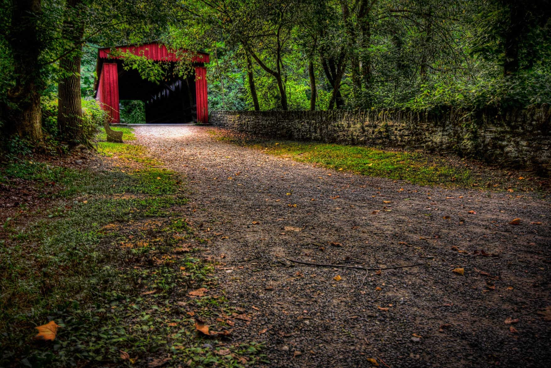
So, brunch first. Then we walk it off up Forbidden Drive, a wide gravel road beside the creek, to a red covered bridge built in 1855, the last covered bridge left in Philadelphia. We turn around there and come back the same way.
It's about three miles, and flat. Come walk it with me.
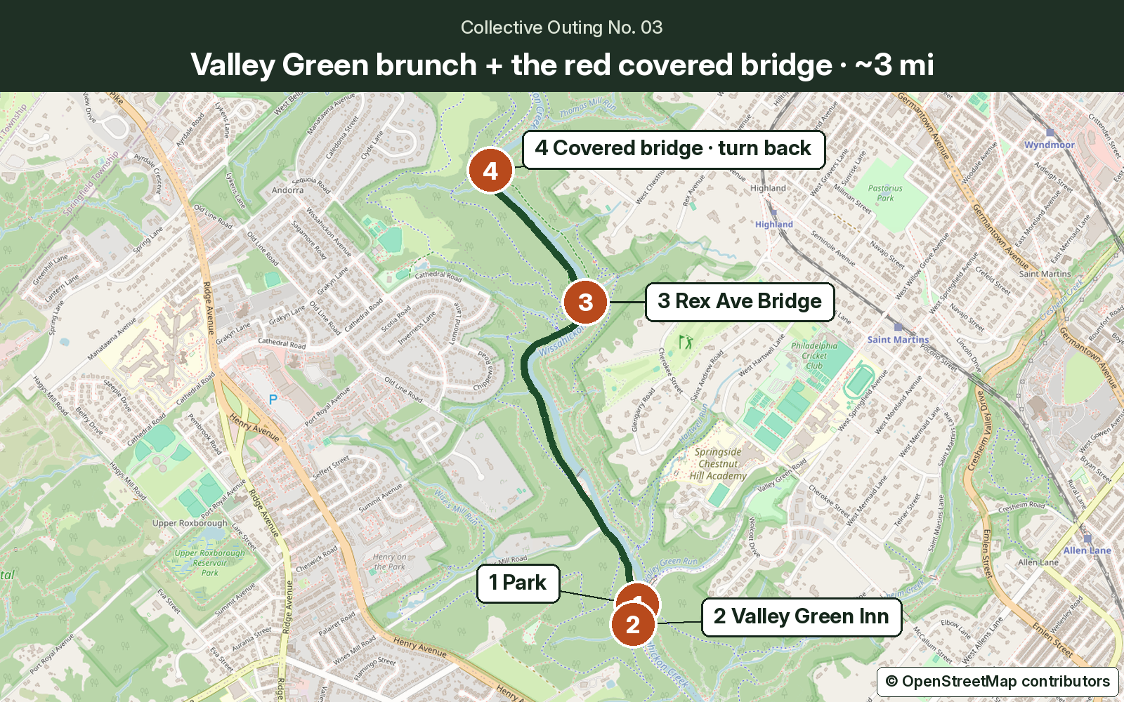
The plan
1. Park. Valley Green Lower Lot South sits right beside the Inn, at the end of Valley Green Road. The Inn notes that "during peak season and private events, the parking lot closest to the inn may be restricted to patrons only." We're patrons, since we're eating there. If it's full, take Lower Lot North: come down Wises Mill Road to Forbidden Drive, and the lot is about a quarter mile along, roughly a hundred yards from the Inn, per the Inn's own directions. The Upper Lot on Valley Green Road is the third choice. Please don't park on Livezey Lane or Kitchen's Lane. The Friends say those are the only emergency routes into those parts of the park.
2. Meet at 11:15, brunch at 11:30. Valley Green Inn serves Sunday brunch from 11 to 3. It's 4.7 on OpenTable from 2,090 diners (checked Nov 3, 2026). There's a porch over Forbidden Drive and a fireplace inside. Walk-ins are welcome, but the Inn suggests reservations on weekends, and a sunny fall Sunday is exactly when it fills up. Book a table.

A word about the morning. Sunday is also the Forbidden Run Fest. Its course map runs the race along Forbidden Drive, with the 10K turnaround and an aid station near Valley Green Inn. So the stretch we walk is part of the course, and the runners will be going by while we eat. The organizers say "every runner has to be finished by 1pm," which is why we walk at 1. If a last runner or a cleanup crew is still out, keep right and cheer.

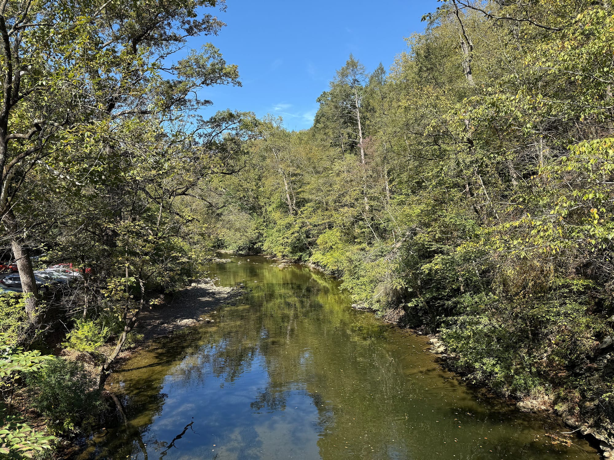
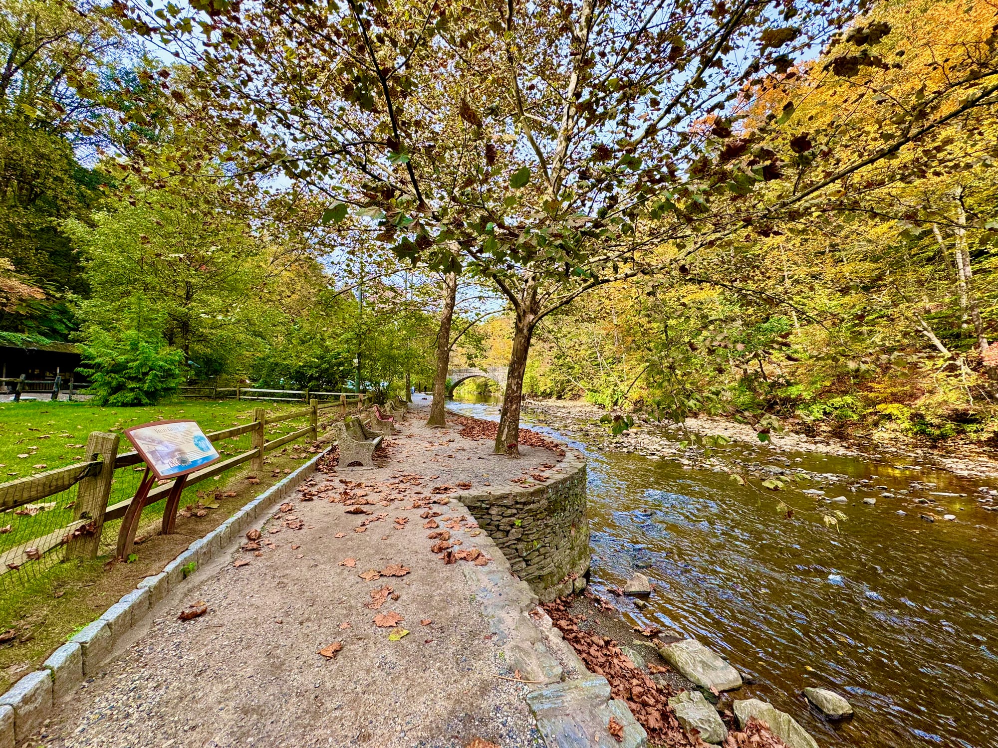
3. Walk at 1: Forbidden Drive to the Rex Avenue Bridge. Head north on Forbidden Drive with the creek on your right. The Friends describe it as "a wide, flat, multi-use gravel path," with a 3 percent average grade. Horses have the right of way, and bikes yield to you. About a mile up you reach the Rex Avenue Bridge, where there are benches and an old park guard house by the water.

4. The red covered bridge, then turn back. About half a mile on, Thomas Mill Drive turns off toward the creek, and there it is. It's the only remaining covered bridge in the Wissahickon, and the only one left in Philadelphia. The bridge itself dates to 1855 and has been on the National Register of Historic Places since 1980; the Friends of the Wissahickon trace a crossing at this spot back to 1737. WPA crews restored it in the late 1930s, and the park did again in 1999. There are benches and picnic tables. Take the crew photo, then walk back the way you came. It's about 1.5 miles to the Inn, and you should be at the cars around 2:30.

On the way back, stop at the benches by the creek at the Rex Avenue Bridge and give it a minute. Back at Valley Green, there are picnic tables and benches by the creek next to the Inn if nobody's ready to leave. The light goes early this time of year.

Bring. Whatever you already own: water, a layer, and shoes you don't mind getting a little dusty.
Before you go
- Weather: as of Friday, Nov 6, the National Weather Service forecast for Valley Green on Sunday is "Sunny, with a high near 61. West wind around 10 mph, with gusts as high as 25 mph." PoP 0%. After Friday's rain, expect soft gravel and puddles.
- Light: sunset is 4:51 p.m. on Sunday. We're back well before then.
- Restrooms: the Valley Green restrooms by the Inn are open year-round during park hours, 9 a.m. to 6 p.m. from November.
- Race morning: see above. Runners finish by 1, and we walk at 1.
- Park updates: check the Friends of the Wissahickon the morning you go.
- Call ahead: the Inn sometimes closes early for private events, and those dates aren't posted online. Call Valley Green Inn at (215) 247-1730 or check OpenTable before you go.
Everything on this page was last checked Nov 6, 2026.
Done it
The photo is the red covered bridge, with your crew in the mouth of it and Forbidden Drive behind you.
Walked it? Tag us or reply with a photo. We're @youroutdoorcollective on Instagram and @YOdCollective on X, and we'll always ask before we share anyone's picture.
Want the next one? Follow along on Instagram @youroutdoorcollective and X @YOdCollective for the next outing.
Photos are from Wikimedia Commons, credited under each one. The CC BY-SA photos are shared here under the same license. Maps © OpenStreetMap contributors. Verify on fow.org the morning you go.
Better weekends, delivered Thursdays.
Trip picks, access notes, and Plan Bs. Free, zero spam, unsubscribe anytime.