Six Saturdays Before Winter
Six autumn outings near Philadelphia: creek walks, garden paths, lakeside picnics, official maps, and a sensible packing list. Keep a Saturday for yourself.

Six autumn outings near Philadelphia. A map, a walk, and something good in the lunch bag.
The calendar has begun making threats. Earlier sunsets. Another invitation. The weekend that somehow becomes a trip to the hardware store.
Keep six Saturdays for yourself.
There is a creek within the city, a lake beyond the traffic, a garden that asks almost nothing of your knees. You do not need a new personality, a rooftop tent, or a heroic alarm clock. You need a little daylight and a plan small enough to keep.
Here are six. Choose them in any order. Send this collection to the person who always says, “We should get outside.”
Get the free Outdoor Collective dispatch →
More Northeast weekend ideas, practical planning notes, and considered gear picks.
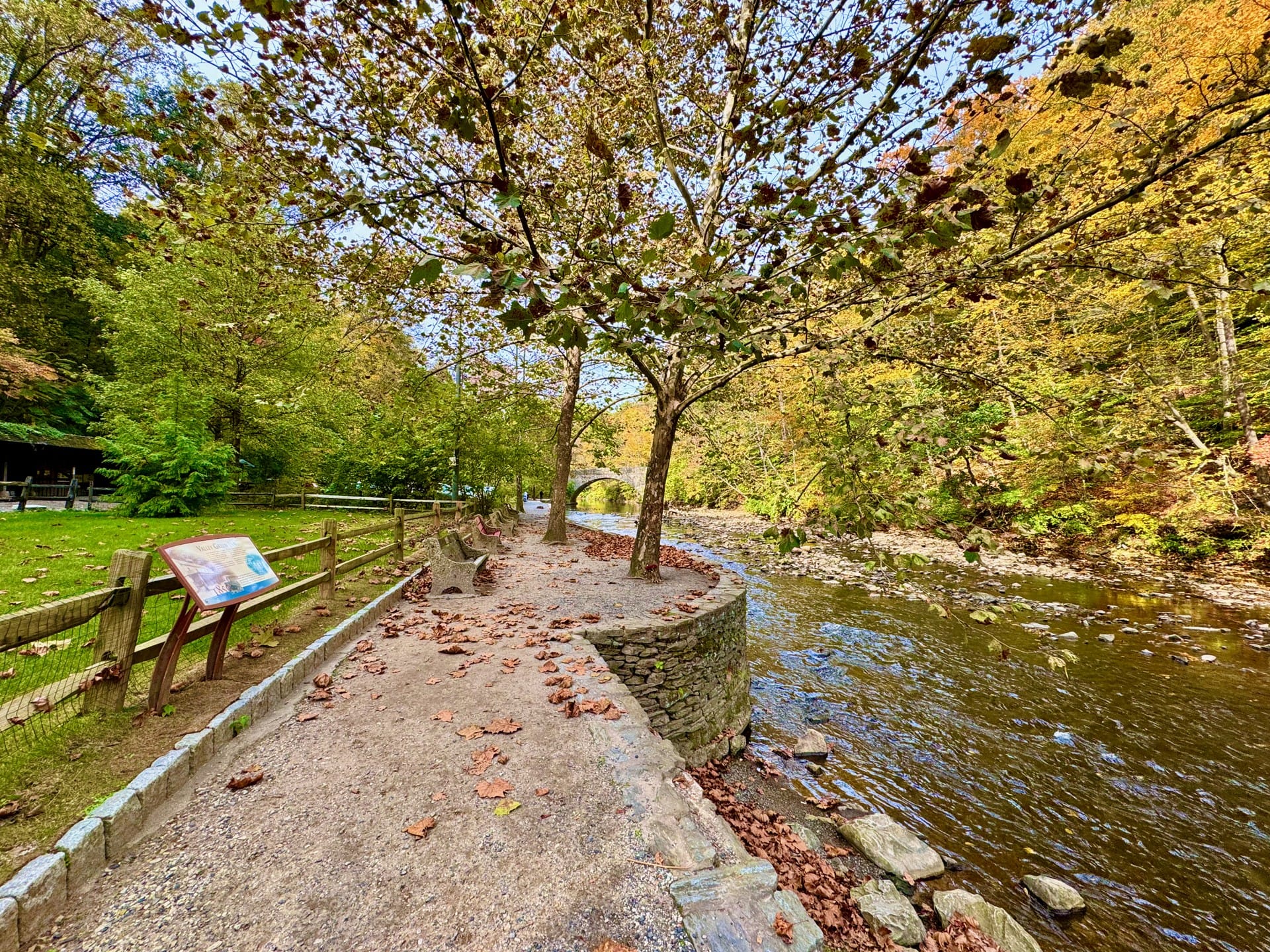
01 / Wissahickon: leave the city without leaving it
Somewhere between the last intersection and the creek, the week begins to lose its grip. Bring the old fleece. Bring the sandwich wrapped rather badly. The trees will not mind.
The walk: Follow gravel-surfaced Forbidden Drive beside Wissahickon Creek. Make it an out-and-back: choose a comfortable turnaround point rather than treating the whole 5.35-mile road as an assignment. Our suggested allowance is 90 minutes for walking, plus lunch.
Arrive: Pick an official parking area from the Friends of the Wissahickon map and identify a backup. Do not park on Livezey Lane or Kitchen’s Lane.
Lunch: A packed sandwich, an apple, and a stop at a mapped picnic area. Carry everything home.
If the weather turns: Shorten the walk in light rain only if conditions are safe. Flooding, thunderstorms, or closures mean choosing another day.
Official map and parking · Check current conditions
02 / Valley Forge: a little more sky

.JPG?ref=outdoor.unitedinnature.com)
Some Saturdays call for a horizon rather than a summit. An open field. A path that lets two people finish a conversation. A flask of coffee growing cooler at exactly the right speed.
The plan: Start at the visitor center area, use the National Park Service map to choose a short walk, and leave time for the park’s history. Budget two hours as a relaxed editorial suggestion, not a route time.
Arrive: The park’s visitor address is 1400 North Outer Line Drive, King of Prussia. There is no entrance fee.
Lunch: Pack a picnic and use a designated picnic area shown on the park map.
Before leaving: Check the NPS alerts. The September 18 update lists intermittent Grand Parade trail closures and a closed Maurice Stephens parking area. Follow posted detours; this is not an all-trails-open report.
Rain plan: Check visitor center hours before making an indoor visit the main event. Otherwise, save the walk for a better forecast.
Official visit information and maps · Current park conditions
03 / Ridley Creek: the small Saturday


There is a particular luxury in doing less than you intended. One garden loop. One unhurried lunch. Home with enough afternoon left to wonder why you do not do this more often.
The walk: The paved Mansion Gardens Trail is a 1-mile loop, rated easiest by the park. Start at the mansion parking area. Allow an hour for the loop and lingering; this is our suggestion, not an official walking time.
Want more? The park also lists the paved 4.3-mile Sycamore Mills Road Trail loop. Treat that as a separate, longer choice.
Arrive: Use the official map for the mansion parking area. The main park entrance is at Sandy Flash Drive South and Gradyville Road. Day-use hours are sunrise to sunset.
Lunch: Put something worth eating in the bag and find a designated picnic spot. The mansion is also an event venue; this outing does not include a promised interior tour.
Rain plan: Pavement may suit a light-drizzle walk, but fallen leaves can be slick. Postpone during storms.
Official trail details and map
04 / Nockamixon: lunch with a lake attached


A lake makes a perfectly respectable destination even when you have no intention of crossing it. Take a seat. Open the lunch bag. Let someone else be in a hurry.
The walk: Start at the marina end of the paved Bike Trail, shared with cyclists. Walk for about 30 minutes, then retrace your steps; add time if daylight and energy allow. This is our suggested outing, not the full trail mileage.
Arrive: Follow the official park map to marina parking. The eastern trail end offers lake views; the trail passes through the day-use area.
Lunch: Bring a picnic for a designated table. A warm drink earns its place on a breezy autumn day.
Rain plan: Skip exposed lakeside wandering in thunderstorms or strong winds. A short paved walk is an option only in mild, safe conditions. Check seasonal facility access before depending on restrooms.
Official trail details and map · Park updates
05 / Ralph Stover: the view can wait for dry ground


A view is improved by having time to stop. And by having the sense to visit on a day when the ground is dry. Some invitations are best accepted with sensible shoes.
The walk: For High Rocks, use the Tory Road parking lot and the official map for the blue-marked section. Choose a short out-and-back within your ability. Keep well away from cliff edges; this is not a place to improvise a shortcut.
A gentler alternative: The separate main picnic area has the 0.1-mile Stover Trail loop beside Tohickon Creek. Use the main park address, 6011 State Park Road, Pipersville, for that outing—not as the High Rocks trailhead.
Lunch: Picnic in the main area. The park has no trash bins: pack out everything.
Rain plan: Save High Rocks for dry conditions. Skip creekside areas during high water; postpone the outing if storms are forecast.
Official trails and map · Park information
06 / French Creek: one last loop


By the sixth Saturday, the habit may have taken. The bag lives near the door. Someone remembers the thermos. The question is no longer whether to go, but which way.
The walk: Choose the 2.5-mile Hopewell Lake Loop, marked brown and rated easiest by the park. It is a hiking-only loop. Allow roughly two hours with stops as our planning suggestion.
Arrive: Use the official map to select parking by the loop. The park address is 843 Park Road, Elverson. Day-use areas open sunrise to sunset.
Lunch: A lake-area picnic, using a designated table. Check seasonal facilities and park notices before leaving, including hunting-area information.
Rain plan: Do not turn wet ground or fading daylight into a mileage challenge. Shorten the outing or come back another day.
Official trail details and map · Park notices
The bag by the door
Use what you already own: comfortable walking shoes, water, lunch, an extra layer, a rain shell, a charged phone, an offline map, and a small first-aid kit. A headlamp is sensible insurance against an unexpectedly late return. Choose a route that leaves you back before dark.
If your current bag does the job, bring it. If you need one, our Osprey Daylite Plus guide is a place to start. For a rain layer, see our Patagonia Torrentshell guide. Check current sizing, availability, and seller details before buying.
Our gear guides contain affiliate links. We may earn a commission when you buy through them. As an Amazon Associate I earn from qualifying purchases. These outings do not require a purchase.
Keep next Saturday open
Save this page. Send it to your walking companion. Then let us help with the next plan.
Join the free Outdoor Collective dispatch →
Planning notes checked against official sources on September 21, 2026. These are researched outing suggestions, not reports of firsthand visits. Times are editorial estimates. Conditions, parking, and seasonal facilities can change; check the linked official notices and the forecast on the day you go. No peak-foliage dates are promised.
Better weekends, delivered Thursdays.
Trip picks, access notes, and Plan Bs. Free, zero spam, unsubscribe anytime.